Scale Reduction in Mineral Exploration Using District-Scale ANT
Mineral exploration is a process of reducing the scale of the physical search space (Fig. 1). The methods used to achieve this are varied and complex, although the local geology, the type of mineralisation being sought and exploration budget are probably the most significant determinants of what methods are used and when. Desktop review is always the first step towards area selection, but what then?
One option is district-scale surveys that can identify prospective geological features at greater resolution than in regional data sets. Fleet Space Technology’s ambient noise tomography (ANT) is one such data type that can assist in reducing the exploration search space. Here we provide a brief overview of our recent work with Inflection Resources on the world’s largest ANT survey dedicated to mineral exploration in the Macquarie Arc, New South Wales.
Ambient noise tomography current use cases
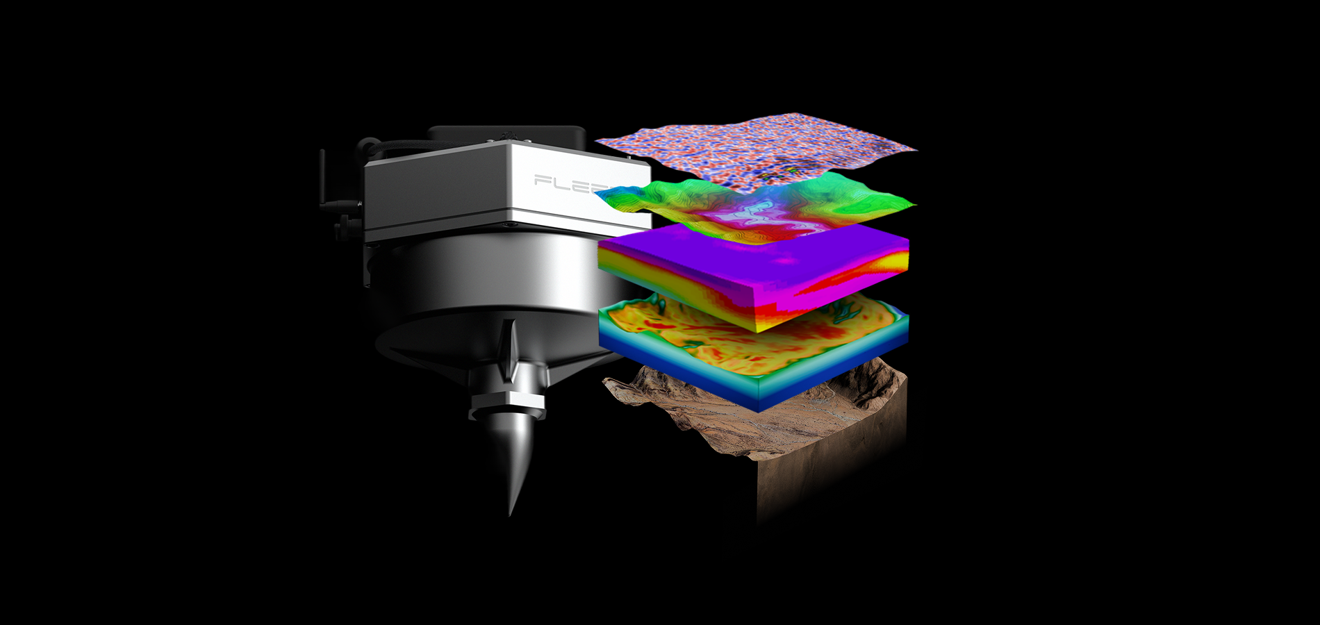
Fleet Space Technologies is increasingly known for ANT as part of its end-to-end mineral exploration solution, ExoSphere. Fleet Space’s ANT process includes distributed arrays of purpose-built passive seismic sensors connected via satellite to provide near real time 3D subsurface velocity imaging. Gravity surveys are now part of Fleet’s expanding geophysical services providing multiphysics capability.
For most of Fleet Space’s clients until now, ANT surveys have been undertaken at the scale of individual tenements or even over individual prospects. The purpose of these surveys has typically been to investigate the extension of known mineralisation or to search for evidence of deeper alteration and structure.
In most cases potential field data was the starting point for initial area selection. However, in our experience when clients have obtained ANT velocity data, new ideas about the location of alteration zones and subsurface structure have emerged that have directly influenced the location of further geophysical data collection or drilling.
Is there a role for applying ANT at the district to camp scale to provide a focus for exploration?

Macquarie Arc district-scale ANT survey
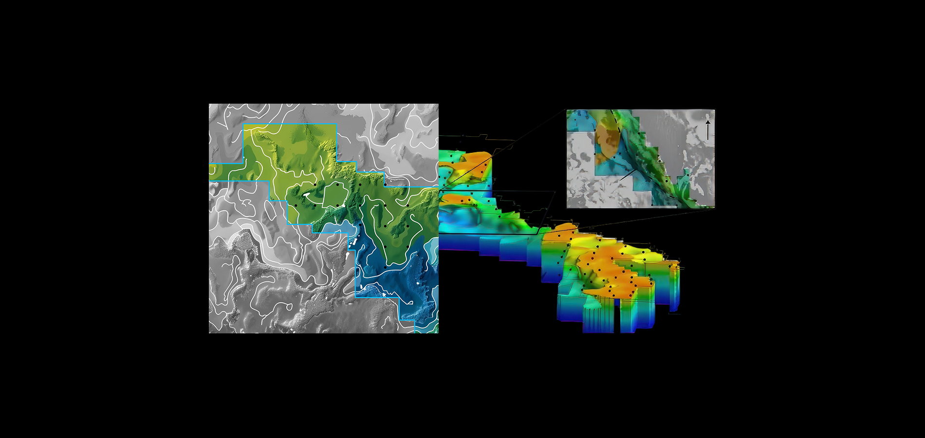
Fleet Space Technologies has partnered with Inflection Resources in the Macquarie Arc to deliver the world’s largest ANT survey dedicated to mineral exploration. This survey extended some 1,800 km2 with a north south extent of over 140 km across contiguous tenements held by Inflection Resources part of an Exploration Agreement with AngloGold Ashanti (see Inflection Resources press release).
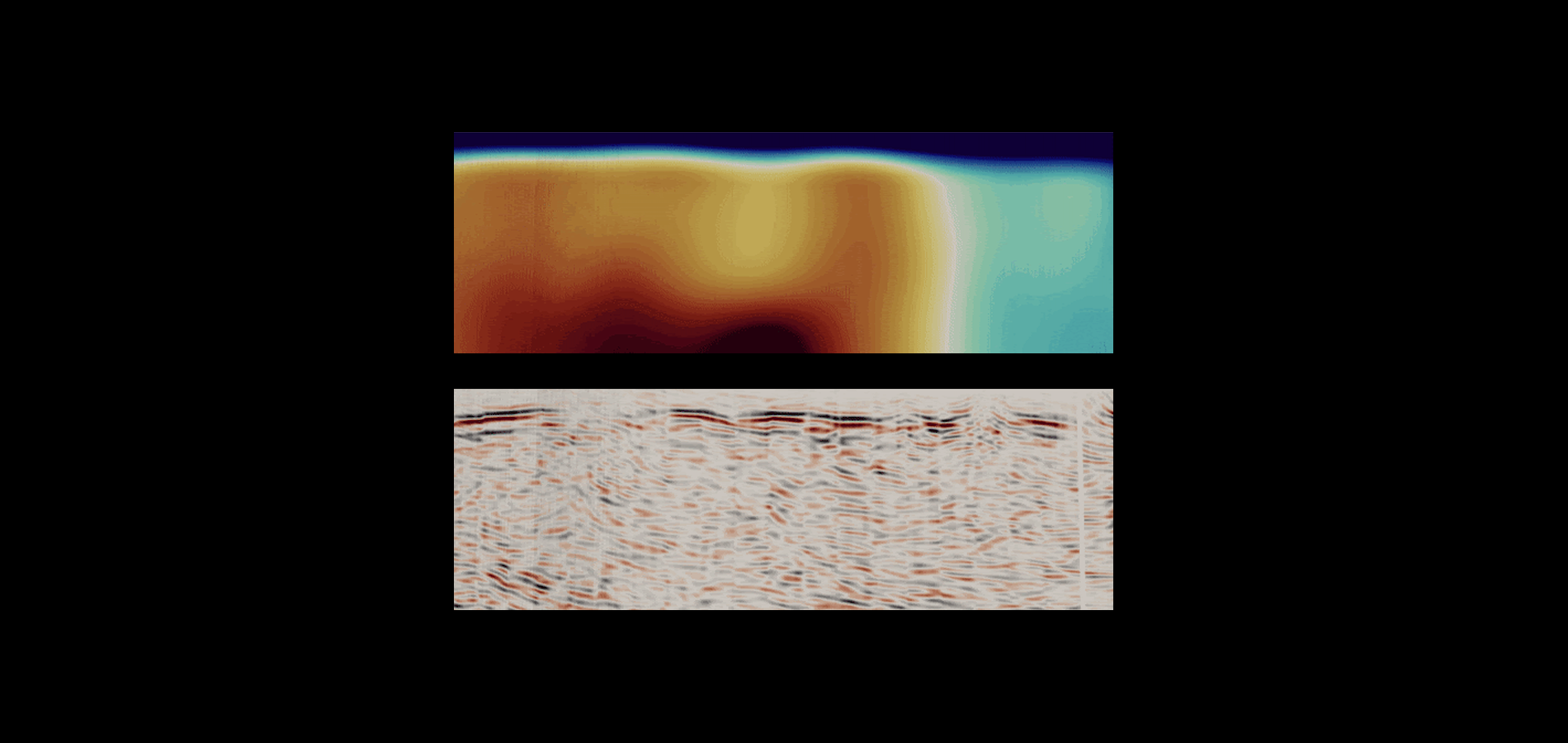
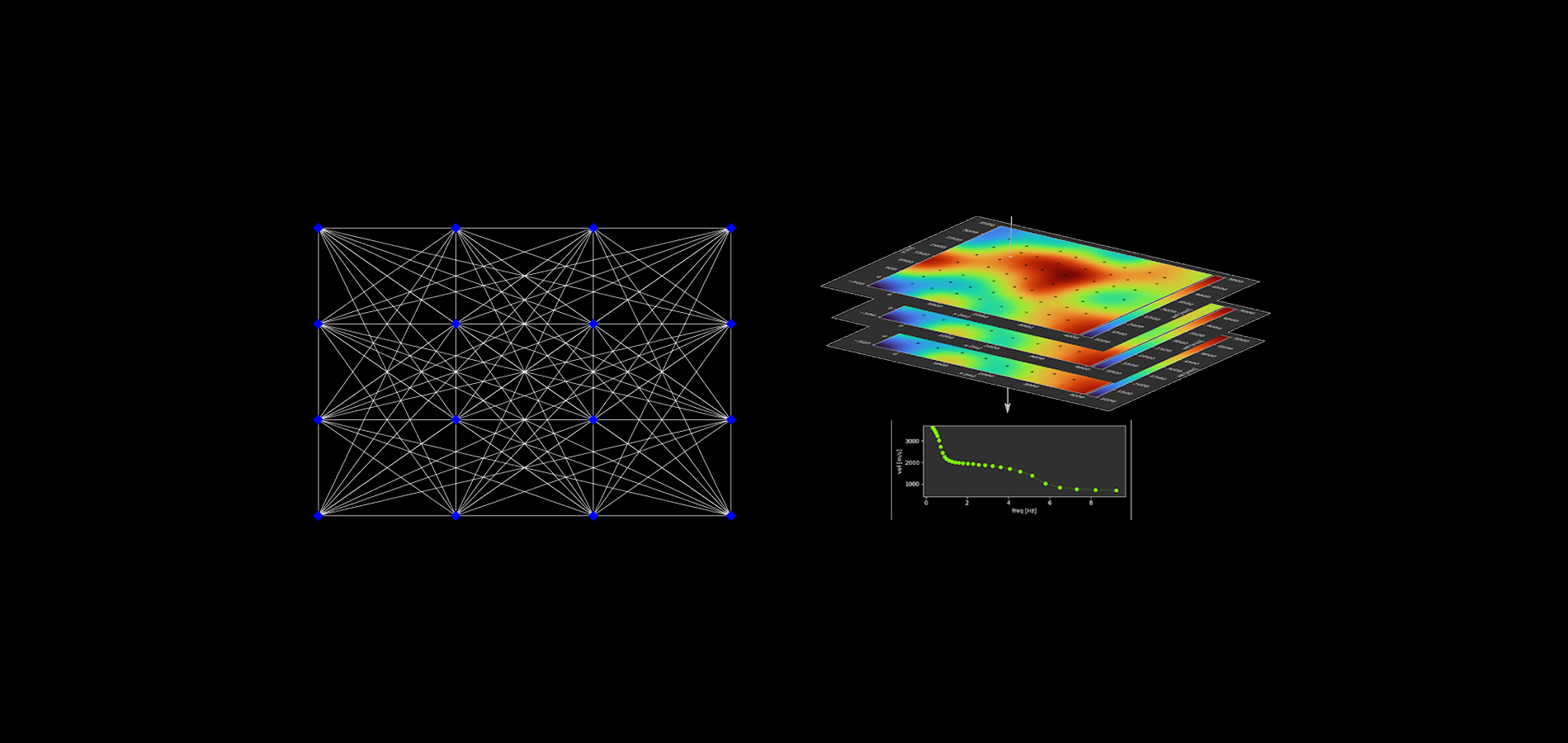
The ANT survey was deployed by field crews from Fleet Space Technologies over a period of 2 weeks in June 2024. Geodes were deployed at a 5 x 5 km spacing. The 5 km spacing approximates the shortest wavelength surface wave that can be recovered and used for imaging and is indicative of the geological length scale to which the data is sensitive. This survey was designed to image large scale geological features and the model is able to identify bulk-scale lithology and large structures across the area. The 3D velocity model from the survey was delivered to Inflection Resources one week subsequent to the completion of the survey.
The survey area contains evidence for a major NW trending shear zone, which extends roughly parallel to the axis of the survey and is also evident in aeromagnetic imagery (Fig. 1). There are several discrete zones of high velocity that correspond to igneous textures in the aeromagnetic images (Fig. 2). At depth, these zones appear to correspond to a zone of relatively high velocity in the upper crust that sits above a regional high velocity zone in the lower 2 km of the survey model.

Significance of the district-scale survey for scale reduction
The district scale ANT aids in the interpretation of possible batholiths. The depth extent of these high velocity zones could be a significant indicator of the size of the plutonic body. In addition the ANT provides an image of possible connections between batholiths at depth and shallower plutons, and this may potentially be showing upper crustal magma plumbing systems.
Since most metallogenically fertile batholiths are complex and multiphase, the presence of possible feeder zones connecting deeper and shallower bodies may be significant. Zones such as this are of exploration interest and areas to follow up on for more detailed surveys and drilling as exploration progresses from the district to the camp- and tenement-scale.

Acknowledgements
This article has been compiled by Anthony Reid with input from Nick Smith and Stephen Barber (Fleet Space Technologies). A peer reviewed journal article is currently in review that discusses the results of the ANT survey in greater detail. Interpretations presented here are those of Fleet Space Technologies and do not necessarily represent those of Inflection Resources. Read the Inflection Resources press release for more information
You might also like