Infinity Mining and Fleet Space Technologies Take the Search for Essential Elements to New Depths at Tambourah South

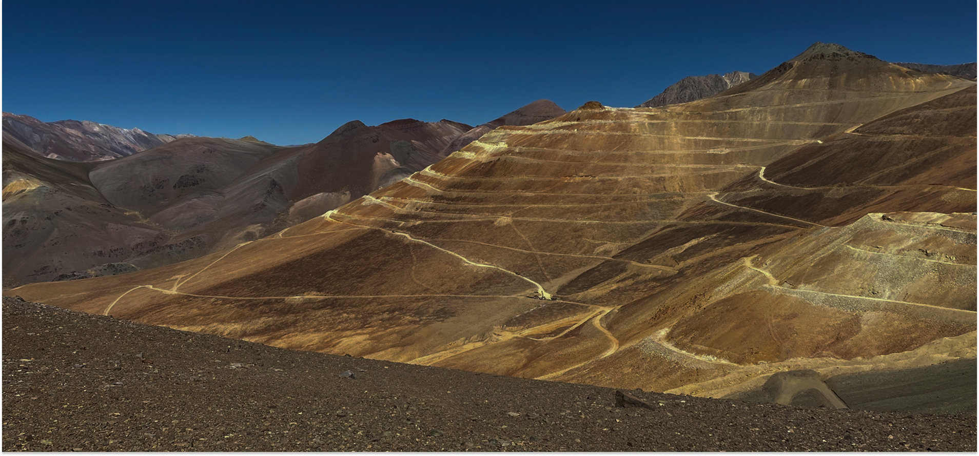
Understanding Tambourah South’s Geology
“We’re delighted to be working on a major domestic mineral exploration project with a fellow Australian-owned company. ExoSphere by Fleet® gives Infinity Mining a unique opportunity to use our advanced ANT technology to map possible lithium-bearing pegmatites, potential host rocks and controlling structures at depth. The system is ideally suited to the rugged terrain of Pilbara, where our Geodes’ light weight and portability really come into their own. Combined with Infinity’s existing data, the ANT data will give the team a better understanding of Tambourah South’s overall geology, aiding drill targeting and speeding up the development of commercially-viable deposits of these vital minerals.”
Flavia Tata Nardini, CEO & Co-Founder,Fleet Space Technologies
Infinity Mining will deploy ExoSphere by Fleet®, to enhance mineral exploration activities and decrease time spent exploring for deposits of lithium, rubidium, and rare earth elements at Tambourah South.
The use of ExoSphere by Fleet®will significantly reduce the amount of scout drilling required, savingtime and resources as LCT pegmatites follow structures within greenstone unitsmaking them elusive and difficult to find using established drilling protocols.
These minerals play a crucial role in several industries, including the transition to renewable energy. ExoSphere's advanced capabilities will allow Infinity Mining to explore deeper and more thoroughly, improving the likelihood of discovering previously untapped mineral deposits. The successful deployment and delivery of ExoSphere at Tambourah South could pave the way for more efficient and effective mineral exploration across the Pilbara’s rugged terrain.
Utilising Low Earth Orbit Satellites
ExoSphere consists of real-time,satellite-enabled seismic nodes specifically designed for mineral explorationin remote settings called Geodes. The Ambient Seismic Noise data is transmittedconstellation of low earth orbit (LEO) satellite, then relayed to computers that use intelligent data processing togenerate detailed 3D subsurface maps. The combination of Geodes and satelliteconnectivity allows small teams to map vast amounts of land accurately and withlitte to no environmental disturbance. Plus, unlike traditional methods, whichcan take months to years to complete, data collection and processing can becompleted in a matter of days.
Ambient Noise Tomography to Identify Lithium-Bearing Pegmatites
Ambient Noise Tomography (ANT) will enable Infinity Mining to map where lithium-bearing pegmatites identified at the surface are going at depth, if they are thickening up and whether they are merging with other pegmatites. It will also help identify concealed pegmatites that don’t have surface expressions, and provide 3D mapping of favourable host rock units and structural controls on pegmatite development.

At Tambourah South, the data will be collected over a one-month survey period. The aim is to map the pegmatites dykes at depth and identify areas where the pegmatites have formed large structurally controlled Li-REE deposits. The lightweight, portable Geodes are easy to deploy in the area’s rugged topography, where conventional techniques make mapping and defining the extent of pegmatite swarm difficult.

ExoSphere by Fleet®’s passive seismic Geodes record the ambient seismic noise within the Earth’s upper crust, generated both by natural sources such as wind and wave action, and human activity such as nearby mining operations and even vehicle movements. This near real-time data is transmitted by satellite to computers that build it into a complete 3D picture of the entire subsurface structure down to several hundred meters in depth.
Joe Groot, CEO of Infinity Mining, commented:
“The ANT technique is easy to deploy, data is recovered in real-time and requires no ongoing fieldwork once in place. If the technique proves useful at Tambourah South, Infinity could also deploy it in other tenements where cover and topography are hindering surface exploration and drill targeting. I would like to personally thank Dr Darryn Hedger (Infinity Mining) and Mr Steve Ledger (Fleet Space) for their collaboration in adapting this new imaging technology to suit lithium exploration in the Pilbara region of Western Australia.”
Don't miss out on other exciting partnerships we've announced – read more about our first Canadian customer, Power Nickel.
You might also like
.png)